
Precision matters in the field.
The underground world is complex; without the right device, it stays silent. This high-sensitivity gradiometer combines the reliability field professionals need, the measurable and shareable data engineers look for, and an easy-to-learn, enjoyable discovery experience for hobby users—all in one body.
Buy now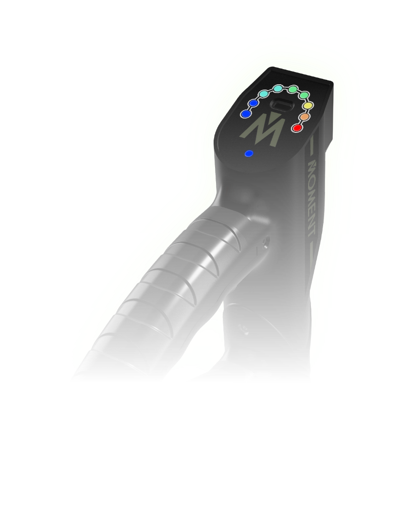
Precision matters in the field!
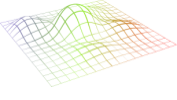
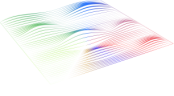
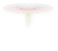
The 3D surface-area chart helps subsurface anomalies become understandable—not just visible.
Measurement depth up to 8 meters with adjustable depth sensitivity delivers controlled, repeatable results across ground types.
Pinpoint marks targets clearly; the LED-assisted pinpoint system enables pinpoint detection even without a phone.

Engineering-grade workflows keep your data: 3D charts export to CSV, and older scans reload for comparative analysis.
3D interpolation adjusts visualization detail on demand; depth-distance measurement helps turn field data into report-ready insights.